Earth and Space Sciences Regents, June 2026, question 24
Tap an image to open it full size.
What the figure shows
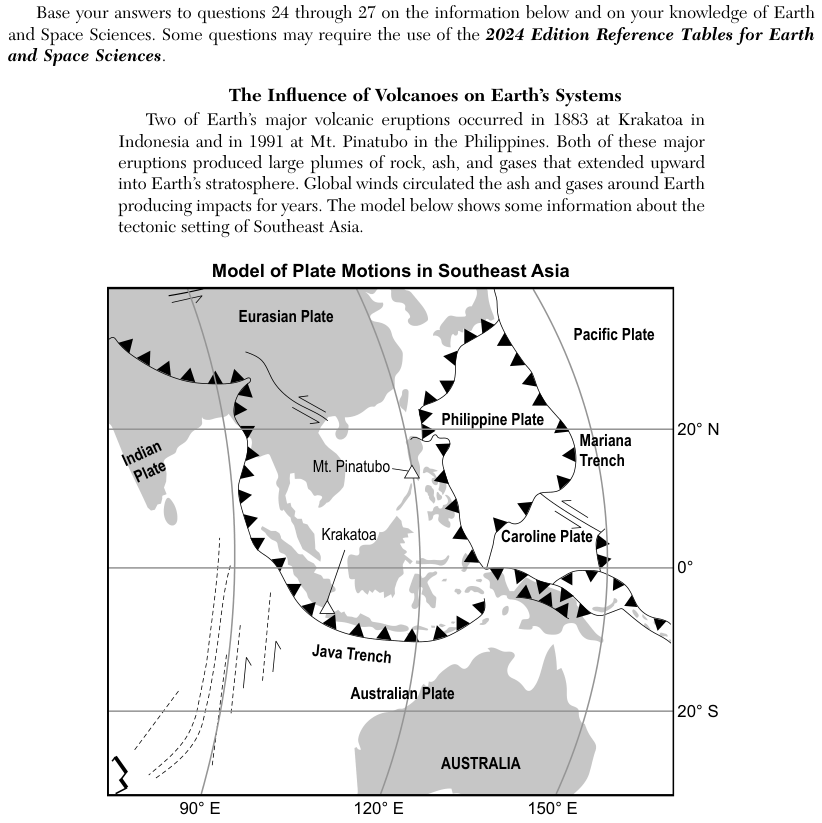
The map, Model of Plate Motions in Southeast Asia, shows the Eurasian, Indian, Australian, Philippine, Caroline and Pacific Plates, with latitude lines at 20 degrees N, 0 degrees and 20 degrees S and longitude lines at 90, 120 and 150 degrees E. Plate boundaries are drawn as lines; lines with black triangles mark trenches, such as the Java Trench and the Mariana Trench, and half-arrow symbols mark some boundaries where plates slide past each other. Mt. Pinatubo is marked by a triangle near 15 degrees N, 120 degrees E, and Krakatoa by a triangle near the Java Trench.
How to think about it
Find Mt. Pinatubo on the map and look at the plate boundary closest to it. Check the boundary symbol: lines with triangles mark one type of boundary and paired half arrows mark another. Then read which two plates meet along that boundary.
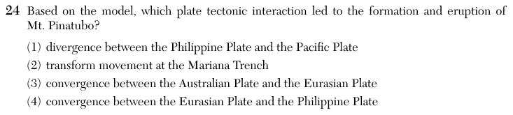
Based on the model, which plate tectonic interaction led to the formation and eruption of Mt. Pinatubo?
Choice 4 is right. Mt. Pinatubo lies next to a boundary drawn with triangles, which marks a trench where one plate sinks beneath another. The plates meeting there are the Eurasian Plate and the Philippine Plate. As the sinking plate goes down into the mantle, it releases water that helps rock above it melt, and the rising magma feeds volcanoes such as Mt. Pinatubo.
The boundary between the Philippine Plate and the Pacific Plate is drawn with triangles, which marks convergence, not divergence. It is also far to the east of Mt. Pinatubo.
The Mariana Trench is a convergent boundary, shown with triangles, not a transform boundary. It lies far to the east of Mt. Pinatubo, near 145 degrees E.
The Australian Plate and the Eurasian Plate do converge along the Java Trench, which produced Krakatoa. Mt. Pinatubo is far to the north of that boundary. This choice may come from mixing up the two volcanoes in the passage.