Earth and Space Sciences Regents, August 2026, question 36
Tap an image to open it full size.
What the figure shows
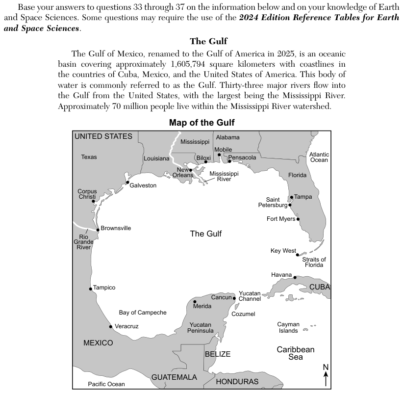
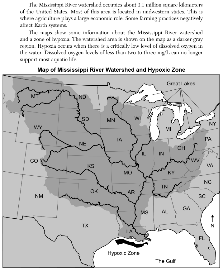
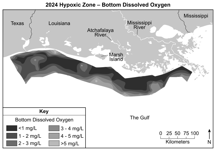
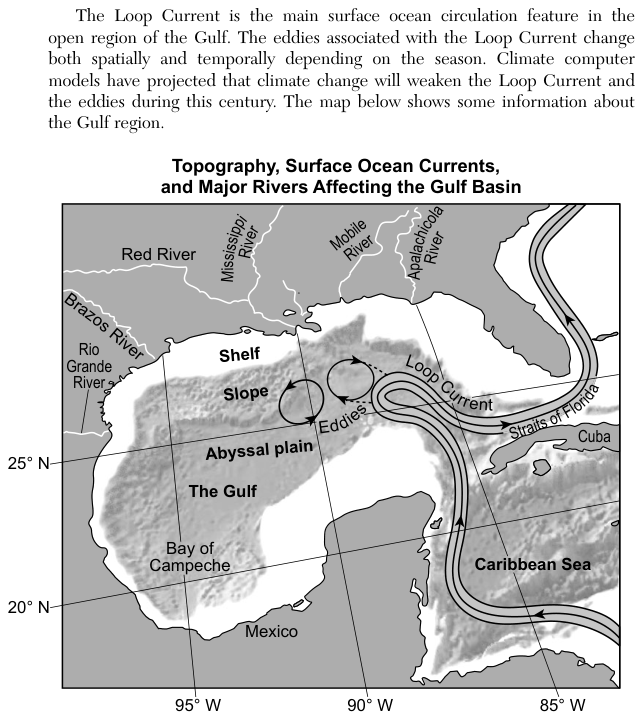
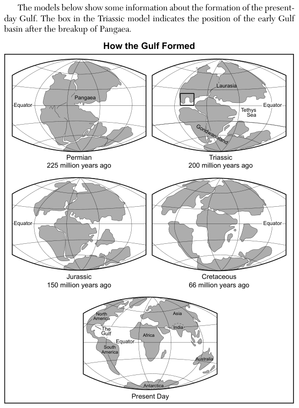
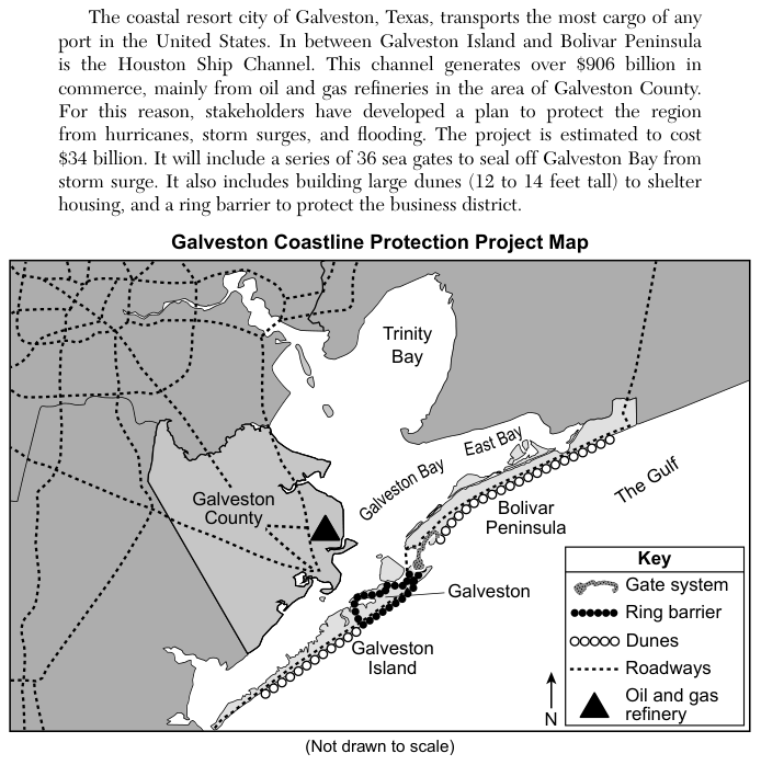
The passage describes the Gulf (the Gulf of Mexico, renamed the Gulf of America in 2025), the Mississippi River watershed and a hypoxic zone (an area of very low dissolved oxygen) off Louisiana. A later passage says Galveston, Texas, transports the most cargo of any port in the United States, and the Houston Ship Channel generates over $906 billion in commerce, mainly from oil and gas refineries in Galveston County. A $34 billion plan to protect the region from hurricanes, storm surges and flooding includes 36 sea gates to seal off Galveston Bay from storm surge, large dunes 12 to 14 feet tall to shelter housing, and a ring barrier to protect the business district. The Galveston Coastline Protection Project Map shows the gate system between Galveston Island and Bolivar Peninsula, a ring barrier around the city of Galveston, a line of dunes along the Gulf side of Galveston Island and Bolivar Peninsula, roadways, and an oil and gas refinery in Galveston County.
How to think about it
The stem asks for a solution that does two things at once: helps people keep living in the area and protects living things. For each statement, ask who or what the solution protects, and whether it does anything for the natural environment as well as for people.
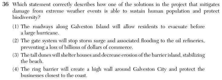
Which statement correctly describes how one of the solutions in the project that mitigates damage from extreme weather events is able to sustain human population and protect biodiversity?